Nature in the UK appeared to receive a rare funding boost in the June spending review, with the government setting a spending target of up to £2 billion a year for England’s environmental land management (ELM) scheme by 2028-29.
By steering public funds toward farmers who restore hedgerows, soils and wetlands, England’s ELM programme is meant to renew landscapes that absorb carbon, support pollinators and keep water clean while helping rural businesses stay viable in a changing climate.
If delivered in full, the package would elevate the UK’s post-Brexit model of investing public money in shared ecological care (rather than payments based on acreage) to one of the most generously funded in the world.
Yet, scrutinise the details and a more complicated story emerges.
Get your news from actual experts, straight to your inbox.Sign up to our daily newsletter to receive all The Conversation UK’s latest coverage of news and research, from politics and business to the arts and sciences.
The review has trimmed the day-to-day budget of the Department for Environment, Food and Rural Affairs (Defra) in real terms. Defra now faces the unenviable task of signing and monitoring thousands of new ELM agreements with fewer staff and shrinking data resources. Without the capacity to check whether fields really have become richer in skylarks or streams clearer of fertiliser, large sums could be delayed or misdirected.
Scale is another challenge. An independent analysis published in 2024 estimated that roughly £6 billion every year across the UK is needed to bring agriculture in line with the Environment Act targets for habitat restoration and net zero commitments.
Even the full £2 billion promised for England would meet only about half of that evidence-based need. And the “up to” £400 million for trees and peatlands is not new money: it is funding that was first promised in 2024 and the payment schedule has still not been confirmed.
Money could be paid to farmers for allowing woodlands to regenerate. Richard Hepworth, CC BY
While the review earmarked £4.2 billion for flood and coastal defence, it does not specify how much of that will support nature-based measures such as floodplain restoration, or the creation of saltmarshes or riparian woodlands. The Environment Agency is consulting on a funding model that could embed such solutions, but the Treasury papers are silent on who will pay for that shift.
Tech spending dwarfs habitat investment
Contrast this with the sums heading to the Department for Energy Security and Net Zero.
Roughly £30 billion is earmarked for nuclear fission, fusion research and carbon-capture hubs. These projects are heavy on concrete and steel (materials with a hefty carbon cost) but have no immediate ecological benefit.
While new low-carbon technologies are crucial, thriving and resilient soils, wetlands and woodlands nourish food systems, safeguard water and hold vast stores of carbon – benefits that deepen and become more cost-effective over time.
Nature-based solutions can also revitalise local economies. The Office for National Statistics estimates that replacing the benefits flowing from the UK’s forests, rivers and soils – flood buffering, crop pollination, cleaner air, recreation and more – would cost about £1.8 trillion, a figure that only hints at their deeper, immeasurable value.
Yet the review sets out no plan to safeguard these life-support systems, or to factor their decline into the Treasury’s green book (the rule book used to appraise public investments) or the Bank of England’s stress tests, which check how shocks could ripple through the financial system.
This is also a matter of fairness and public health. Growing evidence shows that regular contact with nature lowers the risks of heart disease and anxiety, while improving children’s cognitive development. These are benefits with a value that defies any price tag.
Yet the places with the fewest trees and parks tend to be the same post-industrial towns ministers want to “level up”. The review is silent on biodiversity net gain (the flagship policy meant to channel private finance into local habitats) and on a proposed national nature wealth fund that could blend public and private capital for large-scale restoration.
Housing money could repeat past mistakes
One line in the spending review could still shift the balance.
The chancellor has earmarked £39 billion for building social and affordable housing over the next decade. If every development delivers at least a 10% net gain for biodiversity onsite, and if schemes build in climate-smart design (living roofs, shade-giving street trees, permeable surfaces) with local residents, Britain could pioneer the world’s first large-scale, nature-positive, net-zero housing programme.
Without those safeguards, “levelling up” risks repeating old mistakes: sealing green space under concrete today and paying tomorrow to retrofit drainage, shade and parks.
Green space is scarce on this new housing estate near Cardiff, Wales. Shutterstock
That risk is heightened by the government’s planning and infrastructure bill, now before parliament. In an open letter to MPs, economists and ecologists warn that the bill would let developers “pay cash to trash” irreplaceable habitats by swapping onsite protection for a levy, a move they describe as a “licence to kill nature”.
At the next UN climate summit, Cop30 in Brazil in November 2025, the UK will have to show the world that its domestic spending matches its international rhetoric.
More than 150 UK researchers made that point in an open letter to the prime minister, urging him to put nature at the centre of the UK’s Cop30 stance. Converting the Treasury’s headline figures into habitat gains and locking robust rules into both the planning bill and the housing drive would give ministers credible proof of progress when they update the UK’s climate and nature pledges on the Cop30 stage.
The spending review may have nudged farm policy in the right direction and set a new higher water mark for nature-positive agriculture. Yet amid the squeeze on Defra, the recycling rather than expansion of tree and peat budgets and the continued dominance of technology over habitat, nature still comes a distant second to hard infrastructure in the UK growth model.
There is still time to change course. Guaranteeing Defra’s capacity, publishing a timetable for the tree-and-peat fund, reserving part of the flood budget for community-led nature-based solutions and hardwiring strong biodiversity net gain rules into housing and planning reforms would turn headline promises into projects that enrich daily life while stewarding public money wisely.
Don’t have time to read about climate change as much as you’d like?
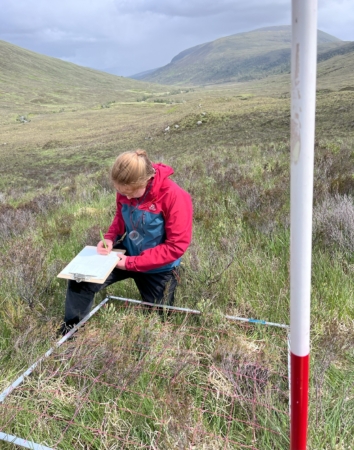
We have just completed two weeks of successful data collection in Caledonian pinewood in the Scottish Highlands. Using passive acoustic monitoring to survey bats and birds, and trialling a method for assessing invertebrates.
As often happens with fieldwork, we had a clear reminder that you should always expect the unexpected and be prepared to adapt plans. Two days before we were due to leave Ella had a bike accident, leading to a mild concussion and a collection of bruises. After the all-clear from A&E and 24 hours’ delay, we set off for Scotland, very grateful for the contingency day we had built into a fairly tight schedule.
We have been working in a Caledonian pinewood remnant in Glen Mallie, which runs south from Loch Arkaig. Glen Mallie’s pinewood lost many of its mature Scots pines after a fire in the 1940s and has since struggled to regenerate due to the impact of deer browsing the young trees. We are interested to understand how this affects the birds, bats, other mammals, and insects it supports, comparing the species found in the remnant to adjacent areas of regenerating pinewood on the shore of Loch Arkaig and to the unforested heathland nearby. A fence has recently been put up around this remnant to exclude deer from the forest and give the young trees a chance to grow and establish.
Working in fairly remote sites, with sampling points spaced a minimum of 500m from each other, the project has required a lot of walking. Pushing our way through dense heather and bracken, crossing streams and bogs, and scrambling up and down hills, we have been intimately connected to the landscape (and very familiar with the ground on the many occasions we have fallen over). In addition, one of the regenerating woodland sites, the Gusach, was only accessible from Loch Arkaig, requiring the use of a boat. We were fortunate to have the assistance of Liam, Loch Arkaig Site Manager for Woodland Trust Scotland, who on several days kindly ferried us across the Loch and back. These challenges in accessing our sites highlighted the benefit that passive acoustic monitoring can bring in this wilder environment. Collecting multiple days and nights of data without the need for exhausting repeated trips over difficult terrain; hard enough in daylight and frankly dangerous to attempt during the nighttime.
The upside of our slow progress on foot has been full immersion in a landscape humming with life. The sheer abundance of wildlife, and rare plants round every corner, is a joy for any ecologist, a stark reminder of all we have lost in much of the UK, and a call to protect, celebrate, and restore the biodiversity of the Highlands. The puddles in boggy hollows are full of newts, frogs leap ahead of you with every step, dragonflies skim past, butterflies and moths flit through the heather, lizards scurry out of sight, and on a couple of days golden eagles soared above us. In the forest, we have stumbled (often literally) across carpets of wood sorrel, alpine lady’s mantle, and the pinewood specialist serrated wintergreen. On the open hill the bogs are filled with insectivorous round and oblong-leaved sundews and common butterwort, and lesser butterfly orchids are beginning to flower. All the while, birds peep and pip, chit and chirp, trill and twit around, filling out the soundscape. Our sampling points were allocated on a 500 m grid before we set out, each one taking us to a random point in the forest that we might never otherwise have visited. This led to the discovery of our favourite tree of the trip. A gnarled alder with a rowan and holly growing embedded from the rotten centre of its trunk. From a distance the three trees create the perfect rounded form of a single tree, but looking up from below each species stands out, making up the canopy of a mixed native woodland. In the moss growing near the base of the alder’s trunk we spotted a tiny birch seedling, a possible future addition to this mini community.
Anyone who has visited the Highlands will know the weather can be reliably variable and we experienced showers, wind, and sunny spells most days. Unfortunately, on a few days and nights, the wind and rain impacted our audio recordings, causing lower activity of our study fauna as well as extra background noise. Despite our mixed luck with the weather, initial scans of the audio data have shown diverse species activity. Many bird species can be heard calling, including rare Eurasian Treecreeper calls in the regenerating forest. We were surprised to discover a particularly determined Eurasian Wren begin its dawn chorus at 2:30 am, with the rest of the community – including chaffinches, wood and grasshopper warblers, great tits, blackbirds, and robins – waking up more slowly. Excitingly, four bat species’ echolocation calls were recorded at the forest sites, with feeding buzzes and social calls also detected. In one recording, two Soprano Pipistrelles can be heard interacting as one echolocates, catching midges in-flight, while the other, likely a male, makes attempts at serenading with melodic chirrups. Other small mammal sounds were picked up too, such as the shrill squeak of a pygmy shrew.
Part of this pilot survey work was to assess the possibility of using passive acoustics to monitor invertebrates in this landscape and insect buzzes can be heard in many recordings, which is promising.
Back in Oxford we are beginning analysis, using a combination of AI pipelines and manual verification of the songs and calls to generate species presence and activity data within each habitat type. We are really excited to see what the results tell us about the bird, bat, other mammal, and invertebrate communities that the remnant pinewood supports, and how this compares to the better quality pinewood nearby and adjacent unforested habitat.
There is widespread recognition that the ongoing and rapid decline of the natural world cannot continue, both for the sake of our fellow species and hist ecosystems, and for humanity itself. The agenda of large-scale action to restore the natural world has gained prominence in recent years, with policy initiatives ranging from local and national through to the UN Decade of Ecological Restoration and Global Biodiversity Framework of the UN Convention on Biological Diversity. Governments, conservation groups, and academic institutions recognise that striving to protect what remains of the natural world is no longer enough—we must also repair some of the damage that has been done.
There is a plethora of terms to describe this new agenda, including restoration, nature-positive actions and rewilding. Whilst all these terms have their merits, we argue that nature recovery is a particularly salient and needed term that captures this ambitious, multiscale and interdisciplinary vision. However, to date, the term remains poorly defined, a mix of very technocratic concepts linked to specific policies and a broad umbrella term covering a broad range of conservation and restoration activities. There is an opportunity, indeed a need, to develop a definition that highlights concepts and approaches that nature recovery can embrace without providing a strong constraint on its use. At the Leverhulme Centre for Nature Recovery at Oxford University, we have (not surprisingly) come up with what we would like to propose as a good definition, which emerged after consultation from a wide range of disciplines. This definition is gaining some traction, and in this article, I will unpack it and explain why I think it is useful. But first, let’s have a brief history of the term nature recovery.
The term nature recovery originates in the United Kingdom, where it is embedded in national environmental policy. The UK’s 25-Year Environment Plan, published in 2018, introduced the concept of a Nature Recovery Network (NRN)—a large-scale initiative designed to create and link wildlife-rich habitats across the country. The NRN aims to rebuild biodiversity by reconnecting fragmented landscapes and ensuring that natural areas are not just protected but actively restored. Following this, The Environment Act of 2021 made Local Nature Recovery Strategies (LNRS) a statutory requirement. These strategies compel local authorities to map out areas where nature restoration should be prioritised, integrating nature recovery into spatial planning. Other initiatives, such as the UK Wildlife Trusts’ Nature Recovery Network Handbook, provide practical guidance on how communities, landowners, and policymakers can contribute to ecological restoration. As another example, the UK’s Environment Agency has launched the Nature Recovery from Source to Sea program, focusing on restoring rivers, wetlands, and coastal ecosystems. Nature recovery is now a term widely employed in UK environmental policy.
The goal envisioned in these polices is not only about preserving existing green spaces but about expanding and connecting them, recognising that nature needs to thrive even in human-dominated landscapes. In the meantime, the word has spilt out from its specific policy origins to become a convenient umbrella term for a broad range of activities associated with protecting and restoring biodiversity.
While “nature recovery” has become prevalent in the UK, it has synergies with a wide range of international initiatives aimed at large-scale recovery of biodiversity and ecosystems. The United Nations has declared 2021–2030 as the Decade of Ecosystem Restoration, encouraging governments to rehabilitate degraded ecosystems. The Society for Ecological Restoration (SER) defines ecological restoration as the process of assisting the recovery of an ecosystem that has been degraded, damaged, or destroyed. In Europe and North America and increasingly more widely, rewilding is a resonant if sometimes controversial term, emphasising the restoration of self-sustaining ecological processes through reintroducing keystone species or their functional equivalents and reducing human intervention. The context is very different in the vast semi-natural landscapes of North America, where the emphasis has been on ecological connectivity, large herbivores and top predators such as the wolves of Yellowstone, and in the densely populated landscapes of Europe, where the emphasis has been on iconic species such as beaver, and on the use of semi-domestic animals such as feral cattle to replace functions once provided by megafauna and even extends to expansion regeneration of vegetation, and wilder gardens and cities.
Another widely employed term is nature-based solutions, which organisations such as the International Union for Conservation of Nature (IUCN) and the European Commission use to describe projects that use natural processes to address environmental and societal challenges—such as restoring wetlands to mitigate floods or planting trees to cool urban areas or restoring forests for carbon sequestration. Though these terms share similarities with nature recovery, they often focus on specific methods or scales of intervention, or specific goals. Some, like rewilding, have become occasionally embedded in culture wars and viewed with suspicion.
The Leverhulme Centre for Nature Recovery is an interdisciplinary centre created in 2022, focused on understanding what is needed to realise the vision of restoring the natural world. It recognises that this requires broad thinking that stretches beyond ecology to the social and political sciences, economics, humanities and the medical sciences. Alongside implementing a range of research activities across this agenda, we embarked early on an interdisciplinary discussion of what we mean by nature recovery. Here is the definition we came up with:
“Nature recovery is the activity of helping life on Earth to thrive by repairing human relationships with the rest of the natural world.”
This definition fixes no baseline or endpoint for nature recovery: by “helping life on Earth to thrive”, it prioritises the direction of travel over the endpoint. We think that this definition is more flexible and inclusive than terms like rewilding or ecological restoration. Nature can recover in schools, in workplaces, in cities, in farmlands and in wilder areas. Hence, it serves as an umbrella term for a broad range of activities that increase biodiversity and enhance ecosystem functions. This is important in recognising that it is insufficient to focus activities in well-protected areas alone; natural processes need to connect and flow across human-modified landscapes and seascapes, especially in an era of climate change. Urban areas can also be hotspots of nature recovery activity because they can host surprising levels of biodiversity compared to intensively farmed countryside, and they offer the primary point of nature connection for an increasingly urbanised human species.
A second feature of this definition is its focus on repairing human relationships with the rest of the natural world. This recognises human relationships as a key requirement for nature recovery, and that humans emerge from, and are embedded within, the natural world, thus rejecting human-nature dualism. Environmental degradation is not simply an issue of lost forests or declining wildlife—it is a systemic issue rooted in economic models, governance structures, and cultural attitudes. This definition emphasises that nature recovery is fundamentally about transforming how humanity as whole interacts with the rest of the natural world, though there is much to respect in and learn from the world’s many cultural and spiritual traditions. The theme of human relationships stretches from intimate local connections with nature through to nature connection and the benefits it can provide in our education and public health systems, through to a deeper examination of how and why our modern economic and cultural systems are leading to a breakdown of the natural world, and how we can work with these systems to develop a realistic vision of human flourishing with the rest of nature. Such a broad definition recognises the need for deeper and transformative change in our culture, values and economies while giving space and encouragement to local and practical actions in urban, agricultural and wilder landscapes. This forward-looking perspective encourages us to reimagine human-nature relationships as opportunities for collaboration and coexistence with the rest of nature rather than sources of conflict and harm.
By placing human responsibility at the centre of nature recovery, we argue that this definition embraces a more holistic approach that addresses systematic issues whilst also enveloping local action. I have argued above why a broader and more inclusive term is needed to address these ambitious goals and systematic challenges and why our definition of nature recovery meets this need. Nature recovery, or a term similar to it in breadth and inclusivity, is an essential concept for the 21st century, where we seek to reverse the decline of the natural world and create a world in which humans and the rest of nature can thrive and flourish together.
Now is the time for nature recovery.
Rewilding a Unique Namibian Landscape
Nestled in the rocky mountains and sandy plains just north of the Orange River, Natural State’s new Namibian project is setting the stage for an ambitious conservation initiative. In partnership with the Orange River Karoo Conservation Area (ORKCA), Natural State is working to develop a rewilding credit—a groundbreaking financial mechanism designed to safeguard this arid yet ecologically rich landscape.
Together with local farmers and communities Natural State and ORKCA plan to connect and restore an area larger than Yellowstone National Park. They have five ambitious goals for this project: 1) to ecologically restore this fragile semi-arid ecosystem; 2) ensure a four-fold increase in the number of native grazers and predators; 3) restore wildlife migration patterns; 4) secure 15 million tonnes of carbon dioxide equivalent and; 5) triple employment in the region through increased capacity of the eco-tourism sector. With these goals achieved, this could be one of the largest rewilding projects in the world.
As part of an ongoing collaboration between Natural State and the Leverhulme Centre for Nature Recovery, Natural State’s Lucy Smyth and LCNR Programme Director Yadvinder Malhi and Nikki Stevens embarked on a fieldtrip to visit the site. Nikki and Yadvinder were able to share their insights and ideas on monitoring biodiversity in arid and ephemeral regions and together they brainstormed how novel nature-based financial mechanisms can help to channel money into conservation.
Following this fieldtrip, Natural State has successfully completed its pilot survey, marking a key milestone in defining the structure of the rewilding credit. By increasing landscape connectivity, it aims to help wildlife move more freely between pockets of resources, fostering stability in a harsh but beautiful environment. Moving forward, Natural State will refine monitoring approaches to measure the credit’s impact, ensuring its effectiveness in preserving this vital ecosystem.
This collaboration is more than just a conservation project—it’s a pioneering approach to align financial incentives with ecosystem restoration. And with dedicated researchers and conservationists at the helm, the ORKCA landscape is poised for a sustainable future.
Exploring Kenya’s Savannas: Insights from Megha Ojha’s Fieldwork
Leverhulme Centre for Nature Recovery postdoctoral researcher, Megha Ojha, recently embarked on an inspiring journey to Kenya. Here she visited the Natural State Research Centre, a non-profit organization actively working in the Kenyan savannas, a region of unparalleled ecological significance.
Megha is a postdoctoral researcher in the Ecosystems Lab in the Environmental Change Institute, where she is working on the development of a biodiversity intactness index for tropical savannas. Her research focuses on understanding the ecological health of savannas, particularly in relation to herbivory intensity and various management interventions.
The primary goal of Megha’s field trip was to immerse herself in the ongoing collaborative efforts between Natural State and Oxford. Her visit focused on gaining deeper insights into their long-term research initiatives and practical conservation work. Megha explored several long-term monitoring plots spread across diverse conservancies, offering her a glimpse into the intricate dynamics of savanna ecosystems and nature recovery efforts in these areas.
During her time in Kenya, Megha had the opportunity to observe the dedicated field team in action. She watched as they skillfully deployed camera traps and AudioMoths—innovative tools for monitoring wildlife and acoustic landscapes. Additionally, she joined ornithologists conducting bird point count surveys, an essential method for assessing avian biodiversity in the region.
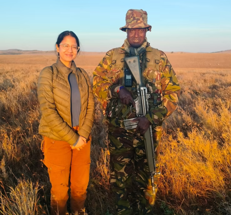
Megha (left) accompanied by an armed game ranger to ensure her protection during fieldwork. These rangers are uniquely trained to safeguard animals from poaching and humans from the dangers of poachers and wild animals
Looking ahead, Megha is preparing for an exciting return to Kenya this June. The upcoming trip will be part of a month-long functional trait campaign, involving a large, multidisciplinary team from Oxford, Kenyan conservancies, and Natural State. The project’s aim is to quantify plant functional traits across different management sites, providing invaluable data to better understand and protect these ecosystems.
Megha’s work exemplifies the collaborative spirit and dedication necessary to address global ecological challenges. Her experiences underscore the value of field-based research in driving impactful conservation strategies.
Improving data pipelines for monitoring nature recovery in Africa
Nature recovery is advancing globally and Natural State is ensuring that Africa is not left in the dust. Over the past two months, the University of Oxford has hosted Natural State’s Dr Lucy Smyth, to work with Dr Nikki Stevens, Oxford’s Trapnell Fellow in African Environments, to develop a novel way of recording and monitoring carbon and biodiversity data collected at Natural State’s nature recovery sites in Africa.
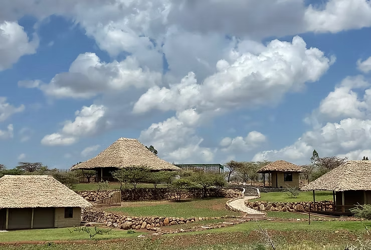
Lucy is a conservation scientist for Natural State, an organisation that is actively building the foundation for nature-based solutions in the Global South. The Natural State Research Centre lies at the base of Mt. Kenya in the Laikipia County and is surrounded by open grassland, shrubland, dense forest, and wetlands where diverse, natural populations of plants and animals thrive in this unique landscape. There are a range of land management methods being utilised in this landscape, including pastoral community conservancies, smallholder agriculture, community forest reserves, and private protected areas. Multiple organisations are currently testing innovative conservation and restoration initiatives in the region, providing an opportunity to monitor nature-based solutions in Africa. The Natural State Research Centre has the most advanced carbon lab in Northern Kenya which allows its team to advance conservation and restoration approaches in the region.
Natural State Research Centre at the base of Mt Kenya in the Laikipia County. Photo credit: Natural State
This is where Lucy and Nikki first met. Lucy had recently joined Natural State as a conservation scientist, to help develop robust and scalable ways of monitoring change in biodiversity, so that restoration projects with positive outcomes can be recognised. Nikki was visiting the research centre to advise on the setup of Natural State’s long-term carbon and biodiversity monitoring plots. Given Nikki’s vast experience as a savanna ecologist and her role as a Trapnell Fellow in African Environments at Oxford, she provided a unique link between Natural State’s work on monitoring change in savanna systems and the Leverhulme Centre for Nature Recovery’s work globally. Through this connection Natural State has become a case study for us, and to help increase collaboration between the two groups Lucy worked from Oxford for two months.
While visiting the University of Oxford, Lucy and Nikki have been developing data streams to allow field data on carbon and biodiversity to flow seamlessly through a series of checks and balances and be displayed on Natural State’s Impact Monitoring dashboard. These data pipelines are unique because they ensure data provenance, allowing changes in carbon or biodiversity to be used to inform financial mechanisms for nature. In addition to developing these data pipelines, Lucy and Nikki have been brainstorming exciting ideas about how biodiversity can be monitored and valued, particularly in the context of savanna systems where too often carbon is optimised to the detriment of biodiversity. While virtual meetings offer great opportunities for international collaboration, the face-to-face time that Lucy and Nikki have had has greatly developed their research and will be instrumental to Natural State’s ongoing biodiversity and carbon monitoring.
Ensuring gold standards are followed for green spaces to help create healthier, more sustainable, and climate-resilient communities
A new paper published in Frontiers in Environmental Science describes a comprehensive menu of standards for green infrastructure in England to help deliver green space that is accessible, connected, multifunctional, and reflects local character.
Here Alison Smith, a Senior Researcher with the Leverhulme Centre for Nature Recovery, who helped compile the standards, explains how following them can improve overall wellbeing and environmental quality.
Green infrastructure (GI) such as street trees, parks, green roofs and raingardens can play a vital role in keeping our towns and cities clean, cool, safe and healthy. However, GI needs to be carefully planned to make sure we have enough green space for people and nature to thrive. To help local authorities deliver high quality, multifunctional GI that meets local needs as well as national priorities, Natural England has been developing a framework of GI Principles and Standards in partnership with a broad range of researchers and practitioners.
I’ve been working with Natural England to help curate existing standards and guidelines into a comprehensive framework consisting of a ‘Core Menu’ and five ‘Headline Standards’. The Headline Standards have already been released, and now a new paper has been published describing the draft Core Menu to support the delivery.
The Core Menu moves beyond simplistic metrics such as total green space to deliver GI in line with Natural England’s 15 principles.
• Plans should meet the five ‘What’ principles by being accessible, connected, locally distinctive, multi-functional and varied.
• In turn, this should deliver places that meet the five ‘Why’ principles by being nature rich and beautiful, active and healthy, thriving and prosperous, resilient and climate positive, and with improved water management.
• And finally, it should be delivered using the five ‘How’ principles, bringing together a partnership of stakeholders across different sectors to strategically plan GI that is evidence-based and designed to meet local needs, with effective management, monitoring and evaluation.
The paper also shows how these draft standards provide flexibility to help balance national targets on climate, nature and health with the need to meet local needs, constraints and priorities. Crucially, the standards sit within the wider GI framework of supporting tools, advice and guidance, to help planners with limited resources deliver more effective and robust green infrastructure with multiple benefits.
The paper was co-authored by Alison Smith, also affiliated to Agile, Nature-based Solutions Initiative, and Leverhulme Centre for Nature Recovery at the University of Oxford, with colleagues from Birmingham City University, the University of Manchester, Natural England and Peter Neal Consulting.
Beyond ‘technical fixes’: Digital Dimensions of Nature Recovery conference provokes debate at the interface between theory and application
Noemi Duroux, Lotti Jones, Caitlin Hafferty, and Jonathon Turnbull reflect on the 2024 Digital Dimensions of Nature Recovery conference, which created a vibrant, interdisciplinary space for knowledge sharing, posing difficult questions, and forming constructive alliances across science, policy, and practice in the UK and internationally. The following sections explore four interlinked themes around equity and justice, aesthetics and encounters, nature recovery in anthropogenic spaces, finance and governance.
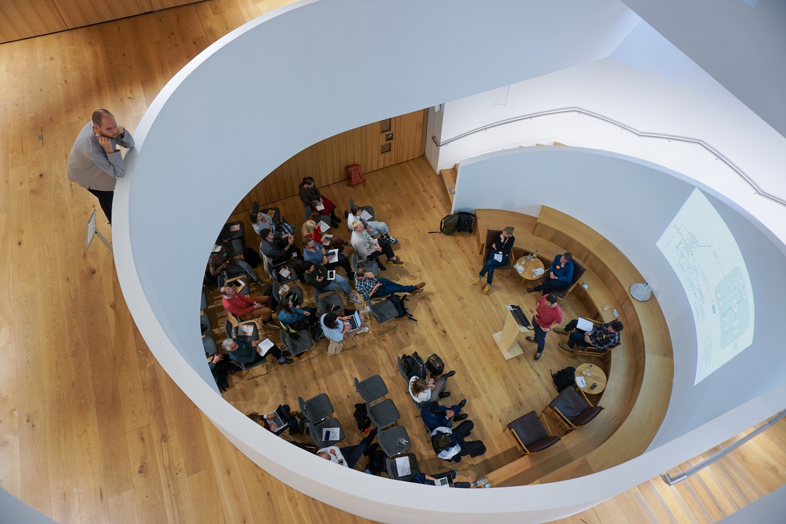
The Digital Dimensions of Nature Recovery conference, held at the Cheng Kar Shun Digital Hub at Jesus College, Oxford, explored the intersection of digital technologies and nature recovery. Supported by the Leverhulme Centre for Nature Recovery alongside the Agile Initiative, Tech Life Lab, the University of Nottingham, and the European Research Council’s BoS project, the conference welcomed an interdisciplinary group of researchers and practitioners conducting nature recovery work at the interface of theory and application. The conference was co-organised by a team of early career researchers at the Digital Ecologies research group, led by LCNR researchers Dr Jonathon Turnbull and Dr Caitlin Hafferty.
Seven panels—spanning agriculture, monitoring, visualisation, remediation, urban nature, equity and justice, and financing—brought together diverse voices including farmers, engineers, biologists, economists, geographers, and artists. A key theme across these panels involved understanding the potential of digital technologies for repairing and restoring natural systems as existing within a complicated web of power relations.
As such, the tension between utopian and dystopian visions of technology were central to many discussions. Are digital technologies opening up, or closing down, possibilities for nature recovery? Such questions catalysed vibrant interdisciplinary dialogue around different (often contrasting and conflicting) interrogations of how digital tools, and processes of digitalisation, change and contribute to broader nature recovery efforts.
While digital tools were understood to inaugurate diverse relationships between different groups of people, and between people and nature—some positive, some negative—participants agreed that it is the work of practitioners, policy makers, researchers, and corporations to develop the appropriate political mechanisms to facilitate the fair and sustainable use of digital technologies for delivering nature recovery at scale.
The Digital Dimensions of Nature Recovery conference created important space for moving beyond polarising debates regarding ‘technical fixes’, where technology is either positioned as the ultimate solution or a barrier to nature recovery. During the event, attendees commented on the value of having this conference space to encounter radically different understandings and approaches to the digitisation of nature, challenging disciplinary and institutionalised assumptions, and provoking difficult questions at the interface between academic research and real-world applications.
Conference participants emphasised the importance of equity and justice in digitally enabled nature recovery. Tom August (UK Centre for Ecology and Hydrology), Hope Steadman (University of Oxford), and Charlotte Chivers (Countryside and Community Research Institute) demonstrated how citizen science and citizen-led smart governance tools can be used to empower local communities, while Mark Hirons (on behalf of Eric Mensah Kumeh, University of Oxford) and Janet Fisher (University of Edinburgh) explored co-production techniques that integrate traditional knowledge and Indigenous science into digital mapping and restoration efforts. Martha Crockatt (University of Oxford) unpacked many of these issues in a practical, on-the-ground community mapping case study in the UK. Such approaches challenge prevalent notions that digital technologies lead to repressive forms of surveillance and gesture to how they may be hacked to prioritise inclusivity and human rights in nature recovery efforts.
At the same time, ethical concerns about digital technologies were discussed, particularly through speculative projects like Mana’olana, an AI interface that enables virtual conversations with other-than-human species—here, a whale. While thought-provoking, these tools raise questions about who designs and controls the algorithms that shape how digital technologies are used and experienced, and the biases and hegemonic power relations that may be encoded into them. Algorithmic justice was thus raised as an important concern for how digital technologies shape nature recovery practices, but also how they shape the stories we tell about nature and whose voices are included (or not) in such stories.
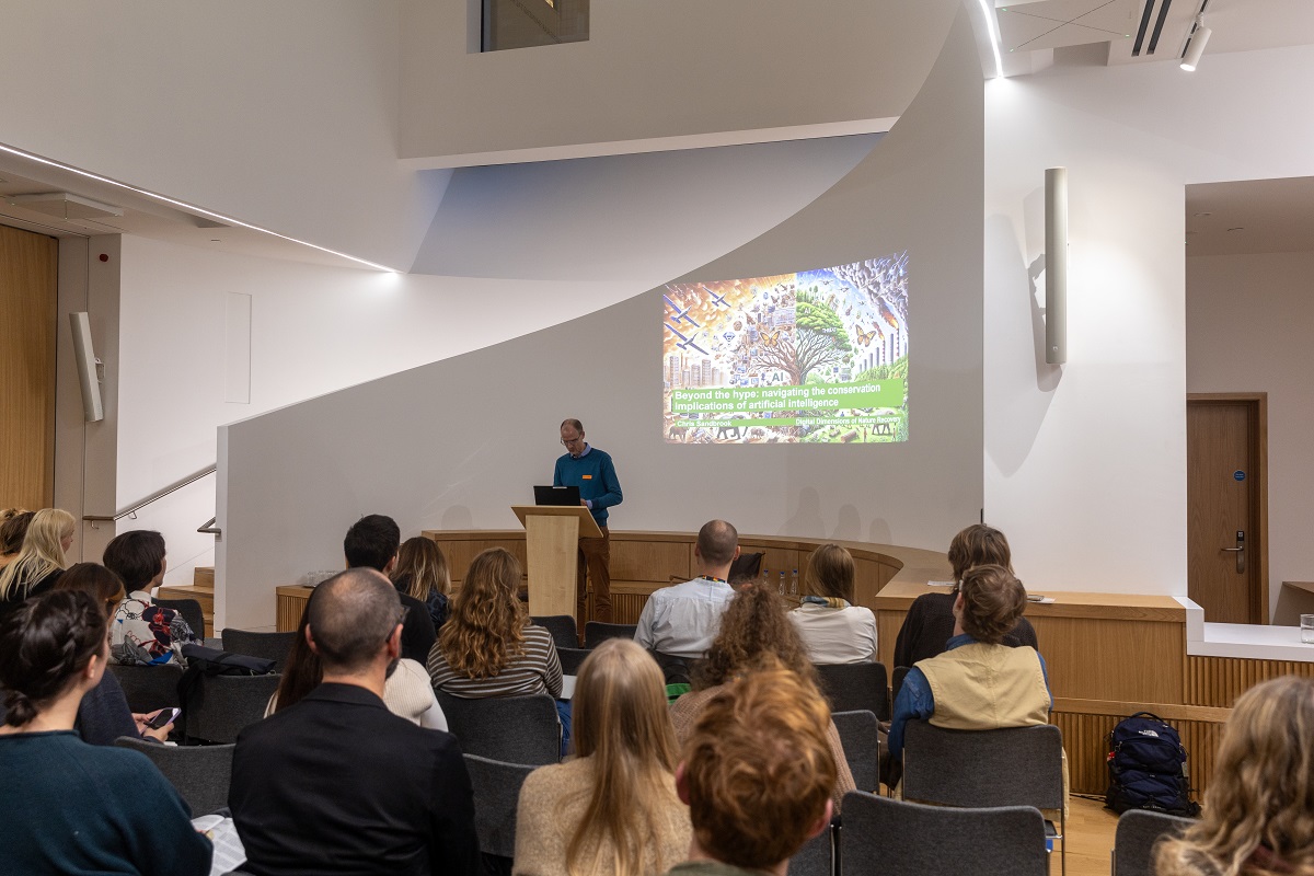
Bill Adams’ (University of Cambridge) presentation raised concerns that digital technologies can be employed for nefarious ends by those wishing to monitor or conduct surveillance on marginalised communities. Bill also extended his concern to how wildlife itself is tracked, managed, and controlled in an objectifying manner by many digital technologies, yet remained open to how technologies can be deployed otherwise. Chris Sandbrook’s (University of Cambridge) keynote talk similarly raised important questions about the role of AI in shaping equitable versions of nature recovery. While AI may make many conservation decisions more efficient, Chris raised a series of risks and unintended consequences that practitioners will have to face when using AI in nature recovery projects to ensure their fair and equitable use.
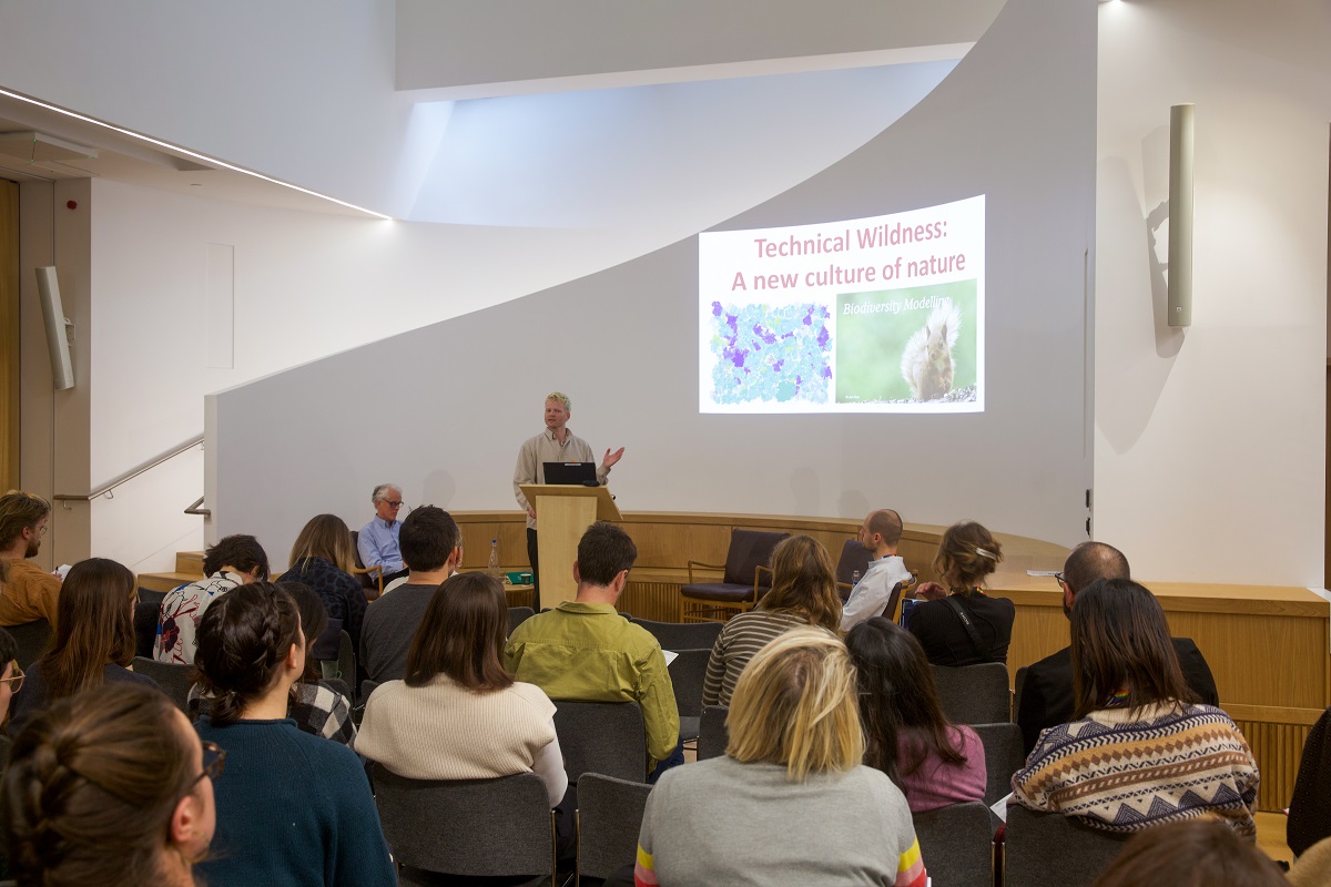
Another recurring theme raised by our presenters was the importance of aesthetics in shaping the politics of digital nature recovery. Whether through Eleanor Thomson’s AI-enhanced habitat mapping at Gentian Ltd., or Theo Stanley’s (University of Oxford) exploration of “technical wilderness” in natural capital projects, the presentations highlighted how digital tools generate powerful aesthetic visions that shape how ecologies are viewed by publics and professionals, opening new avenues for intervening and managing them.
Gillian Rose’s (University of Oxford) analysis of the online circulation of biodiversity data and images revealed how digital technologies blur boundaries between the real and the virtual, creating hybrid ways of seeing nature that are infused with the power dynamics encoded into algorithms. Far from tangential to nature recovery, then, aesthetics was understood by our participants as an important sphere wherein different ideas and visions of nature recovery are rendered palpable matters of ethical and political concern.
Jessica El Mal’s (University of Leeds) participatory art-research project, Forest of Cultures, demonstrated how digital platforms can embed culturally-specific and embodied connections with nature, illustrating how different, perhaps marginalised perspectives on nature can be rendered visible online. Our co-organiser Jennifer Dodsworth’s presentation used a range of digital methods to examine the dominant aesthetics associated with Cumbrian sheep farming online. Challenging some of these romantic representations, Jenny drew from her own experience as a sheep farmer and her research with other farmers to show how other aesthetics are possible on apps like Instagram where she curated a more situated vision of rural life.
Camille Bellet’s (University of Manchester) exploration of farmers’ tactile interactions with surveillance cameras showed how technologies can mediate sensory relationships with nonhuman animals beyond the screen. Jenske Bal (University of Liège) examined attempts to remediate biodiversity through nature-inclusive farming practices. And finally, Francois Thoreau’s (University of Liège) creative and poetic exploration of the aesthetics of AI-generated imagery raised critical questions about how these tools challenge traditional notions of pristine forms of nature that remain so powerful in nature recovery imaginaries.
Nature Recovery in Anthropogenic Spaces
The varying spatialities of nature recovery were also raised across a series of panels. Cities were highlighted as a neglected space of nature recovery policy and practice, while the role of agriculture was brought up in both rural and urban environments as a major driver of nature recovery. These panels challenged perceptions of where nature recovery can take place and with whom.
Elliott Newton from the NGO Citizen Zoo spoke about his rewilding practice in London, where he has reintroduced beavers to the capital (for the first time in 400 years). Ed Baker and John Tweddle presented on their work at the Natural History Museum in London where a host of technologies are being deployed to digitise nature across contexts, including in the Museum’s own grounds, providing a resource for researchers, practitioners, and the public. Tash Barnes (OnePlanet.com) played with the idea of the glitch to think about how rewilding might be done in urban spaces and enhanced by using technologies to foster communities of care and connection between people and place.
In relation to farming, Adam Searle from the University of Nottingham outlined work on high-rise agriculture (i.e., vertical farms) in Singapore, raising a host of questions regarding the hype and promise imbued in certain technologies that are sold as solutions to urgent agricultural questions. Adam highlighted how such ecomodern visions are mobilised otherwise by communities that envision alternative forms of nature recovery. Charlotte Chivers (Countryside and Community Research Institute) focused on citizen-led soil and water health monitoring, which is using a digital platform to record findings, while Jo Furtado (University of Exeter) looked at how participatory mapping and modelling on upland common land in the Lake District can aid in planning the management of land for nature recovery.
Finance and governance underpin and continuously shape the encounters, spaces, and equitable dimensions of nature recovery, provoking both excitement and scepticism from the panellists and audience. Debates around financing nature’s recovery are frequently (and to an extent, unhelpfully) focused on a binary formulation of top-down neoliberal powers versus bottom-up, localised resistance. On one hand, financing mechanisms can either be over-emphasised as a solution to the biodiversity and climate crisis at the expense of other approaches (often with significant equity implications) or on the other hand can be downplayed, or entirely overlooked, through approaches that centre alternative approaches outside of neoliberalism. Moving beyond this, the panellists recognised a more complex and constructive reality involving diverse economies that involve collaborative associations, multi-level governance arrangements, negotiation between different priorities, and building capacity for shared outcomes between scientists, businesses, and communities.
Tom August (UK Centre for Ecology and Hydrology) began the discussions by highlighting how technology is leveraged for biodiversity monitoring through eco-acoustics, computer vision, and the power of citizen science. Despite considerable optimism towards the potential of technological innovation for monitoring, purely technological approaches cannot deliver nature’s recovery and face challenges regarding managing large volumes of data and interpreting results meaningfully. Grounding these issues, Molly Biddell (Knepp Estate) reflected on Knepp Estate’s pioneering approach to landscape restoration and data monitoring in the Weald to Waves recovery corridor and the River Adur Recovery project. Molly explained how new technologies and increasingly precise data collection is essential to ensuring that emerging carbon and nature markets are high-integrity in that they deliver multiple benefits, while mitigating greenwashing and ensuring social safeguards. High-integrity UK carbon and nature markets should also deliver co-benefits for people and nature, highlighted by Rosie Everett (Scottish Rural College) who noted that despite these aspirations, current finance mechanisms often overlook local communities and new approaches are needed to ensure direct community benefits for wider equitable outcomes.
Stepping back, the finance panel acknowledged that although technology holds great potential for unlocking new pathways to funding nature’s recovery, they cannot on their own solve deeper challenges in carbon and nature markets. Sophus zu Ermgassen (University of Oxford) brought these debates together, first outlining the opportunities for the voluntary carbon market and Biodiversity Net Gain in solving real-world problems, then diving deeper into their historic shortcomings that continue to lead to market failures. Sophus attributed these issues to governance weaknesses, arguing that technological innovation is a less important part of the solution and calling instead for broader reforms in political economy and governance structures.
Future Plans
The diverse themes raised across our panels are promising for the future of both scholarship and practice regarding the digital dimensions of nature recovery. Our participants opened important avenues for thinking beyond common binaries and tropes related to the use of digital technologies in the nature recovery sphere and among conservationists. For the most part, they resisted forms of both techno-utopianism (which champion digital technologies as technofix solution to all biodiversity issues) and techno-dystopianism (which paint technologies as severing humans from nature and being involved in forms of repressive surveillance). Equally, these critical concerns were not sidelined, but held in tension with the need to evaluate the use of technologies in diverse situated contexts.
Going forward, we hope to continue these interdisciplinary conversations, connecting policymakers, practitioners, and academics. We are currently developing the proceedings of the conference to be published as a special issue of People and Nature, a journal, we hope, will allow the insights generated at our event to be received by a broad scholarly audience and beyond.
For questions about the event, future plans, and how to get involved, please get in touch with Caitlin and Jonathon.
Beyond the Sensor: Building Blocks for Equitable Nature Recovery
Remote sensing has been around for almost 150 years, with the earliest forms of remote sensing dating back to the 1800s. The first aerial photographs were taken in 1858 by Gaspard-Félix Tournachon, also known as Nadar, using a hot air balloon.
Remote sensing is important because it provides a way to collect data from areas that are dangerous or inaccessible, and it can be used to monitor change over time. It contributes to scientific knowledge by providing valuable information about the Earth’s surface. This includes data on location, depth, biomass, temperature, moisture content, and more. Researchers are using this information to understand various environmental processes better.
The term “remote sensing” was first used in the 1960s. Today, remote sensing platforms include satellites, airplanes, drones, and robots. In this blog, Eric Mensah Kumeh explains why we need to look beyond sensors.
Digital technologies, including remote sensing, now offer exciting opportunities to frame, implement and monitor nature recovery projects at scale. From identifying priority areas to benchmarking vegetation and monitoring change, remote sensing plays an integral role in the design and delivery of numerous nature recovery projects worldwide. Yet, preliminary findings from our equitable nature recovery project in the mosaic landscapes of Ghana emphasize the need to approach these technologies with caution and to look beyond the sensor if nature recovery is to be equitable for both nature and people in project areas.
Drawing on high-resolution multi-spectral imagery of local communities situated at various distances from forest reserves in rural Ghana – where both government and private entities are implementing nature recovery projects – we conducted participatory mapping with local actors to understand their experiences with their land use systems. Our initial findings have been insightful, highlighting at least three key issues.
First, many carbon standards require nature recovery projects to last at least 40 years to meet permanence requirements. However, our participatory mapping shows that land tenure for nearly all land users – including cocoa farmers, vegetable producers, and plantain farmers – is often short-term and tied to the lifespan of the specific crops. These durations vary widely, ranging from six months to 25 years, from vegetable crops to tree crops like cocoa. The mismatch between the requirements of these standards and prevailing land tenure raises questions about who can participate in carbon-oriented nature recovery projects, such as agroforestry, and whether they will have sufficient incentives to stay engaged over time.
The second, related issue is the diversity of crops and land use. Many carbon-based projects are commodity-oriented. Across our study landscapes, cocoa is the main commodity around which carbon projects have been organized even when food crop and cocoa farming are often intermingled spatially. This raises concerns about who is involved in these projects, who is excluded, and on what terms. An alternative approach would involve tailoring carbon projects to pre-existing local land uses, rather than using a one-size-fits-all model that rewards only select groups of actors – even though contributions from all land users are necessary to prevent leakages and ensure additionality.
The third observation relates to local farmers’ existing innovations for meeting their needs while maintaining carbon sinks. In some communities adjacent to or within forest reserves, our participatory mapping revealed complex land use strategies where farmers successfully cultivate food crops, such as bananas, beneath the forest canopy without clearing standing forests. Although such land-sharing practices may technically be considered illegal due to their occurrence in forest reserves, this contrasts sharply with the growing conversion of forest reserves into single-species teak plantations under the rubrics of restoration and carbon. For whom and for what purpose land and nature recovery are implemented become important equity questions in such contexts.
Other interesting findings from the participatory mapping include collective action, where local communities use communal lands for food crops or cocoa farms to raise resources for local development projects, motivated by a perceived neglect in national development agendas and projects.
In summary, these insights underscore the importance of going beyond the sensor to better understand land uses, land users, and their priorities and systems when planning or implementing nature recovery interventions. Sensors provide valuable aerial perspectives on land use; however, a deeper, more engaged interaction with local communities is essential to appreciate their views and ensure equitable outcomes in nature recovery.
In the coming months, our team aims to delve further into the data, leveraging these insights to improve multilevel governance and financing structures, making nature recovery work more equitably for local communities.
In late October 2024, the UN Convention on Biodiversity held its biennial large meeting (the Conference of Parties, or COP). This convention is a sister of the better known one on climate change, both birthed in Rio in 1992, but until the last few years has languished in relative obscurity. This all changed two years ago in Montreal, which produced the Kunming-Montreal Global Biodiversity Framework, an ambitious international agreement which aims to halt and reverse nature loss by 2030, combining protection, restoration, finance and systems transformation. This rise in prominence reflects the rising profile of the ongoing global decline in biodiversity and the need to reverse it as an existential challenge on a par with climate change. Montreal has been called the “Paris-moment” for biodiversity, referring to the signature role the 2016 climate COP in that city had in solidifying ambitions for stabilizing climate and shaping goals of net-zero carbon emissions.
This COP was the opportunity to further develop mechanisms for how the Global Biodiversity Framework would work, as well for countries to present their national biodiversity pledges as promised in Montreal. This was an “implementation COP” focused on working out the delivery mechanisms of the Global Biodiversity Framework. It was always unlikely to catch major global press attention. Things are slow, but the meeting itself provides a stimulus for progress, such as a timeline for to announce targets and showcase pledges.
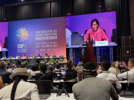
COP President Susanna Muhamad, Colombia’s Environment Minister, speaking at an event on reconciling western and indigenous approaches to nature recovery. It was remarkable to see such bold thinking at the highest political levels.
It is easy to be sceptical about these international meetings, their slow progress and insufficiently resourced ambitions, but what is gradually emerging and solidifying is a global framework for governance of biodiversity. The international UN process certainly can’t solve this on its own, but it does provide an essential global architecture. Ultimately, nations and businesses need to deliver against these targets, but a process is built to create targets and build international mechanisms for finance and monitoring. Multilateral negotiations and agreements are essential but deeply inefficient and frequently frustrating, but also provide a space for smaller countries, and for indigenous peoples and other groups to have a voice at the table.
This year, the meeting was held in the city of Cali in Colombia, tucked in the forest-clad eastern foothills of the Western Cordillera of the Andes, fittingly one of the most biodiverse places on Earth. Lush tropical montane forest stretches above the city, a tree-lined river runs through like a throbbing green vein, surging after the frequent and heavy tropical downpours. This stunning, friendly city has a troubled history and it was gamble for the Colombian government to locate it here, a gamble which I believe paid off admirably. I came to support the activities of the London Natural History Museum, of which I am a Trustee, and to also better understand this emerging global biodiversity architecture and how our activities at Oxford University (including our Leverhulme Centre for Nature Recovery) can address and support these goals.
I have been to some climate change COPs previously, but to newcomers these COPs can be overwhelming. COPs are split into a Blue Zone, accessible only to negotiators and to a limited quota of observers from sectors such as NGOs, academics, media and business, and a Green Zone freely open to all. In Cali the Blue Zone was in a lovely conference area semi-open to views of the lush green hills, a welcome antidote to the nature-free, soul-sucking sterility of many large conference venues. The Green zone was in the heart of the city, in a range of venues clustered around a pedestrianized area joyously hugging the river.
What was achieved in this COP?
Only a small fraction of countries (44 out of 196) have submitted their detailed national biodiversity pledges (National Biodiversity Strategies and Application Plans – NBSAPs in the jargon loved by the negotiations). A larger number (119) have produced less detailed national targets. How biodiversity action can be financed in ways that transfer resources from the resource-rich Global North to the biodiversity-rich Global South, always the thorniest question, still needs to be fleshed out. The meeting ran out of time before all business was completed, with the aim of completing unfinished business in the next two years.
There were two big outcomes:
Firstly, an agreement on Digital Sequence Information that sets a principle and precedent for companies (such as pharmaceutical companies) that use genetic information to ensure small fraction of their revenue is shared fairly with the people living where the resources were discovered, including Indigenous groups, supporting the conservation of such biological wealth.
Secondly, the creation of a permanent body to represent the voices of indigenous peoples and local communities within the framework.
An informal event in the Blue Zone, with COP President Susanna Muhamad and Brazilian Environment Minister Marina da Silva discussing novel mechanisms for funding tropical forest protection
The negotiations are important and essential and there is some excellent coverage of them and their outcomes (I highly recommend the comprehensive analysis and summary by Carbon Brief). Rather than repeat those summaries, here I will focus on two other aspects of the conference that I think get less international attention or understanding by non-participants. In effect, there are at least two other processes going on in parallel to the negotiations.
Yadvinder with UK Secretary of State Steve Reed
One is essentially a conference on biodiversity that brings together governments, policymakers, NGOs, academics, journalists, indigenous peoples, activists, businesses and finance in a somewhat overwhelming flurry of events that stretch from the Blue Zone right across the city. These don’t get the coverage of the main negotiations because they are so amorphous and hard to track. But this is where a lot of the detailed consequences of the Global Biodiversity Framework, and wider thinking about the biodiversity challenge, are being worked out. For example, I attended one session on how researchers are rising to the challenge of developing a global biodiversity data architecture that brings together multiple sources of data and will support and simplify how countries can track and report changes in their biodiversity.
Another session I attended was on how ecosystem restoration activities can be scaled up to meet the target of restoration of 30% of degraded lands by 2030. And another on whether novel approaches based on the intrinsic rights of natural entities (rivers, mountains etc.) can be effective and integrated into national laws and legal systems. And there was a plethora of smaller but hugely significant events such as Brazil launching its plan to restore 12 million ha of its ecosystems by 2035, and presentations of a new mechanism to finance tropical forest protection and restoration. And, even more amorphous, sprinkled in every day were multiple conversations and serendipitous encounters, new agreements to collaborate together on something, new plans being hatched. And the meetings and conversations stretch across disciplines – as an academic I know of no other forum where I can engage so effortlessly with governments, activists, NGOs, journalists and filmmakers.
To the outside this “conference of biodiversity” may seem superfluous to the main negotiations, especially in an age where air travel is rightly being questioned and many have taken the decision to not travel. But I can’t see the speed of activity and collaboration required to address the biodiversity challenge happening in any other way, especially when creating partnerships across countries.
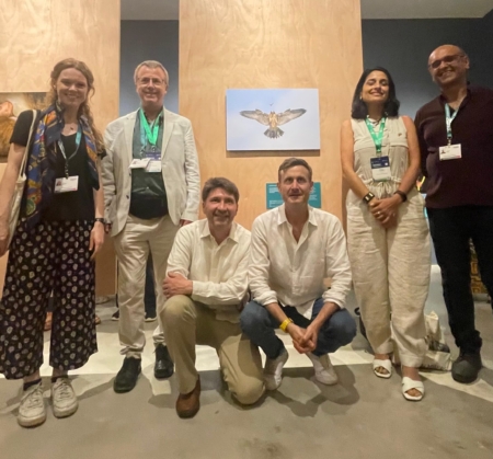
Yadvinder with the British Ambassador to Colombia, George Hodgson, and a team from the Natural History Museum in London, at the launch of the Wildlife Photographer of the Year exhibition in Cali
The third element that matters is the use of the event as an opportunity for mobilization of public awareness, activism and enthusiasm. This was evident in the UK around the Glasgow climate COP in 2021. Biodiversity has languished compared to climate change, but in the last few years it has stepped up a notch with “nature” being a prominent part of public conversation, both in the UK and internationally. But there is so much more to be done. The Colombian government made this explicit in declaring this “the people’s COP”, and they truly delivered. The Green Zone, in the heart of the city, on the pedestrianized streets straddling the Cali river, was packed with stalls and information stands and humming with joy and music ranging from salsa through Afro-Colombian choirs and Andean flutes. Throughout the COP this zone teemed with the public, enjoying the event but also learning and celebrating biodiversity and the natural world. And there were many other events.
I joined the British Ambassador to Colombia in opening the Natural History Museum’s Wildlife Photographer of the Year Exhibition. It was free and easy to walk into off the street: every time I passed by it was full of people enjoying this celebration of the wonders of the natural world. The media coverage in Colombia was intense and joyous, and also there was good coverage in Brazil, and I believe in other parts of Latin America. As an ecologist it was truly wondrous to see such a public and joyous celebration of nature and its importance. It was disappointing there was less media coverage in the UK, something that is needed if we are to better mainstream nature and biodiversity into the public conversation.
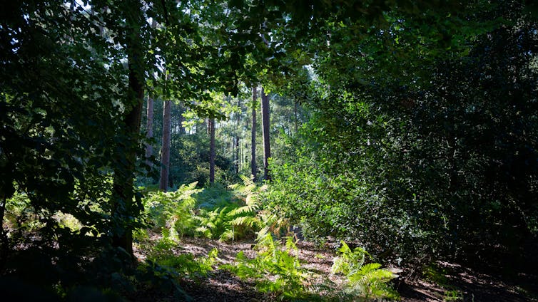
The magnificent forests above Cali harbour extraordinary biodiversity and protect the city’s water
At the end of the meeting, I took a trip out with a local conservationist to the lush cloud forests in the mountains above Cali, and to the tropical dry forests and wetlands to the north of the city. Everywhere was brimming with life, a celebration of the abundance and exuberance of the living world. It was also filled with stories of hope and progress. A forest that had been protected and restored for the protection it supplies to the city’s water supply, and is now found to be home to one of the planet’s rarest birds, discovered only in 2019 (we got to see this charismatic little bird that struts and swings its torso like a salsa dancer – hence its nickname of the “salsita”) and an abundance of gorgeous plants and insects. City ecologists who are implementing ambitious plans for green corridors and public access to nature. A river with multiple tragic stories from past violence but now a focus of community-led projects for reconciliation and reconnection. But also sobering reminders of wider challenges: a bird-rich wetland experiencing two years of continuous drought, hill-sides razed by cattle-gazing and fire, intensive sugar-cane monocultures stretching across the valley.
Amongst the local people (“Caleños”) that I met there was immense pride and joy that Cali was being celebrated as a city of biodiversity, and lending its name and legacy to global efforts to protect and restore the natural world. Biodiversity and nature recovery are ultimately always local and intimate, but they cannot only be local. Somehow, we need to bridge the scales from local to national to global, to try and shift not only global nature governance and finance, but also the values of our modern civilizations, to rebuild our connections with nature, and retell and build new stories about how the natural world is not primarily a commodity, a source of resource extraction to power our economies, but the nurturing matrix from which we emerge and which sustains us. This was apparent in the cosmovisions of many of the indigenous peoples who spoke at the meeting. The whole meeting had the strap-line of “paz con la naturaleza”, peace with nature. The President of the COP, the inspiring Colombian Minister of the Environment Susana Muhamad, spoke of the need to live in synchrony with the cycles of nature. The UN secretary general spoke of ending a war with nature.
After spending ten days in the company of people, both delegates and locals, with so much love for the natural world, in a beautiful, seductive, magical country that is sadly far too familiar with conflict but also with reconciliation and peace-making, I come home energized and empowered. This felt significant. There is so so much to do, but I feel this was an important moment in addressing the huge challenge of creating civilizational and just peace with nature.


 Working in fairly remote sites, with sampling points spaced a minimum of 500m from each other, the project has required a lot of walking. Pushing our way through dense heather and bracken, crossing streams and bogs, and scrambling up and down hills, we have been intimately connected to the landscape (and very familiar with the ground on the many occasions we have fallen over). In addition, one of the regenerating woodland sites, the Gusach, was only accessible from Loch Arkaig, requiring the use of a boat. We were fortunate to have the assistance of Liam, Loch Arkaig Site Manager for Woodland Trust Scotland, who on several days kindly ferried us across the Loch and back. These challenges in accessing our sites highlighted the benefit that passive acoustic monitoring can bring in this wilder environment. Collecting multiple days and nights of data without the need for exhausting repeated trips over difficult terrain; hard enough in daylight and frankly dangerous to attempt during the nighttime.
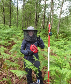 Anyone who has visited the Highlands will know the weather can be reliably variable and we experienced showers, wind, and sunny spells most days. Unfortunately, on a few days and nights, the wind and rain impacted our audio recordings, causing lower activity of our study fauna as well as extra background noise. Despite our mixed luck with the weather, initial scans of the audio data have shown diverse species activity. Many bird species can be heard calling, including rare Eurasian Treecreeper calls in the regenerating forest. We were surprised to discover a particularly determined Eurasian Wren begin its dawn chorus at 2:30 am, with the rest of the community – including chaffinches, wood and grasshopper warblers, great tits, blackbirds, and robins – waking up more slowly. Excitingly, four bat species’ echolocation calls were recorded at the forest sites, with feeding buzzes and social calls also detected. In one recording, two Soprano Pipistrelles can be heard interacting as one echolocates, catching midges in-flight, while the other, likely a male, makes attempts at serenading with melodic chirrups. Other small mammal sounds were picked up too, such as the shrill squeak of a pygmy shrew.