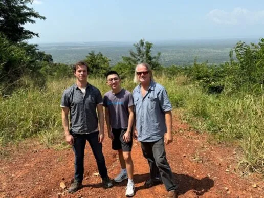
Our Kwahu nature recovery partners, Nature Conservation Research Centre, Ghana and Ostrom Climate called us for help in assessing historical forest cover around the 1950s, which is critically important for its field forests restoration plan. Learn more about the Kwahu restoration site here.
Researchers initially checked LandSat Satellite, which is available up to the 1980s with coarse resolution. Unfortunately, forests were severely degraded around 1980s, thus we needed to track further back in time.
In Ghana, local collaborators have seen several aerial photos taken by the Royal Air Force in 1946, and topographical maps drawn based on these aerial photos, by an organisation called the ‘Directorate of Oversea Surveys’. They believed that a ‘nearly’ complete collection was being held by the Bodleian Library in Oxford, and asked us to help search for these precious materials and decipher the forest cover in the 1950s.
With amazing input from the Bodleian Librarians, researchers at the Leverhulme Centre for Nature Recovery found the necessary maps. They are safety kept in the library and taken very good care of. Despite being printed 70 years ago, they are still glossy and in great condition. Forest symbols are marked clearly on the printed sheets which reveal forest cover in 1950s.

Vegetation information recorded on these maps
Then, AI experts from the Leverhulme Centre for nature Recovery, Steven Reece and Olga Isupova created an excellent tool to convert this information into a digital form that could be used for GIS analysis. The tool turned out to be a great success and recognised symbols on these maps with a 98% accuracy.

In the Bodleian library, Dr Huanyuan Zhang-Zheng is reading details on the ‘Directorate of Overseas Survey’ archival maps, printed around 1950s.
More importantly, the 1950s forests cover map derived from these materials have very high fidelity to field and household surveys, and the original forest range maps were then discussed with local farmers and the extent of the previous forest cover agreed.
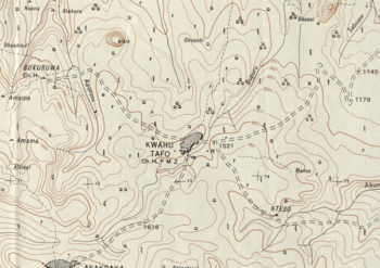
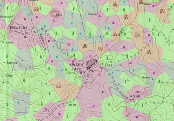
Part of a 1950s historical map showing study site Kwahu at the centre, before AI reading (left) and after AI land use type recognition (right)
Looking to the future, scientists from the Leverhulme Centre for Nature Recovery will be carrying on applying these AI tools to more countries with ‘Directorate of Oversea Survey’ maps available, with Sierre Leon, Belize, South Africa just to name a few!
Related Research Themes

Society
Encompassing the governance and socio-cultural dimensions of nature recovery.
