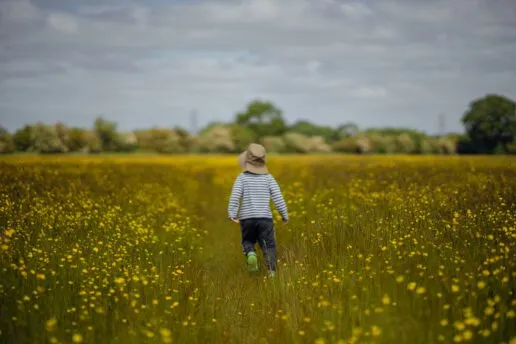

I’ve always enjoyed spending time outdoors – I like the freshness of the air, the sense of open space, and being surrounded by gently changing plants, insects, fungi and birds. When I was growing up this meant playing in our back garden, holidays on the Suffolk coast and hanging out in the park after school. As an adult, I regularly go running in Oxford’s surrounding countryside, and have spent many (many…many…many!) hours in the park with our children. It’s easy to take access to green space for granted when you have it, in both urban and rural areas. However, not all neighbourhoods get an equal share of those benefits.
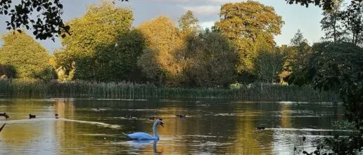
Parks, gardens, street trees, and other natural features, known collectively as Green Infrastructure (GI), are known to have benefits for health, wellbeing, climate resilience, and biodiversity (read more about this here). Green infrastructure provides places for exercise, socialising, community building, nature connection, shade and cooling, flood mitigation and so on. However, socioeconomically deprived areas often have less GI {links}, thus losing out on these benefits. As there is evidence that socioeconomically deprived communities benefit more from GI {link}, it is especially important to identify those that lack access to it. This is particularly important at the present time, when there is a raft of recent and upcoming policy from the UK central government that influences green infrastructure provision, presenting both risks and opportunities, such as Biodiversity Net Gain, the new Planning and Infrastructure Act 2025, the updated National Planning and Policy Framework, Local Nature Recovery Strategies and the Devolution and Community Empowerment bill.
With this in mind, in January 2025 I embarked on a six month Oxford Policy Engagement Network (OPEN) fellowship to study the provision of green infrastructure, who has access to it, and its benefits; the outputs are now ready to share.
During the Fellowship I developed a methodology for assessing how equitably GI is distributed in relation to socioeconomic and environmental need, integrating approaches and data from the Woodland Trust’s Tree Equity Score with work I’d done in Oxfordshire. The project was a collaboration with the Woodland Trust and Plymouth City Council, with myself and Alison Smith (as PI) from University of Oxford.
Put simply, we wanted to create a tool that would help local councils (or other interested parties) to identify communities that have the greatest need of improved access to parks, trees and green infrastructure in general, so that they can enjoy the many benefits provided by these features.
The tool, the AGIE (Assessment of Green Infrastructure Equity) methodology, brings together nine separate measures into a single score for each neighbourhood in a chosen area, using publicly available datasets. These measures are grouped as:
- distribution of GI (greenspace access, greenspace provision, tree canopy cover, manmade surfaces)
- environmental need (air quality, heat disparity), and
- socioeconomic need (Indices of Multiple Deprivation, age dependency ratio, minoritised ethnicity).
Based on the combined score, neighbourhoods are ranked into four groups from highest to lowest need for improved GI equity.
The AGIE methodology is not a standalone decision-making tool, but a starting point for evidence-based planning and collaboration with local communities. By identifying neighbourhoods with the greatest need for GI improvements, it supports efforts to create healthier, more equitable, and climate-resilient cities.
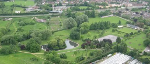
We used Plymouth City Council (PCC) as a case study, collaborating closely with council representatives. Plymouth has 29 km² of green and blue space (37% of its area), of which 30% is publicly accessible. Tree canopy cover is relatively high (17%), but varies widely between neighbourhoods. The city has relatively high levels of socioeconomic deprivation. Applying the AGIE methodology to Plymouth revealed marked disparities in GI equity across the city, with highest-priority neighbourhoods being clustered in the southwest of the city. These highest-priority areas have less than one-tenth the greenspace per person compared to the least greenspace-deprived areas, half the canopy cover, and more than double the proportion of manmade surfaces. They also experience greater heat extremes and poorer air quality.
The findings provide Plymouth City Council with a robust evidence base to target interventions such as street tree planting and greenspace improvements, monitor progress, and strengthen investment cases. The results align with existing local priorities, helping to validate the approach, and add value by quantifying inequity and visualising patterns across the city. Beyond Plymouth, AGIE offers a scalable tool for councils, NGOs, and researchers across England to support equitable access to GI benefits.
For those wanting to use the methodology for other areas of the country, we have provided comprehensive methods that are freely available. There is scope to customise the AGIE methodology, for example through using local datasets with greater accuracy than the nationally available data, using different measures, or adding in further measures such as blue infrastructure. If you would like any support in using the methodology, please contact me: martha.crockatt@ouce.ox.ac.uk
Related News Articles
Oxfordshire’s Greenspace Deprived Neighbourhoods
Martha Crockatt I’m writing this in mid-April; although there has been wind, rain and even hail in the last few days, hawthorn, tulips and forget-me-nots are blooming, bees are starting to buzz and the sun, when it does come out from behind a cloud, is warm – it’s a lovely time to be outdoors in […]

Oxfordshire’s green space-deprived neighbourhoods
A report, released today by the researchers in the Leverhulme Centre for Nature Recovery, identifies neighbourhoods in Oxfordshire experiencing both socio-economic deprivation and poor provision of accessible green spaces, with a view to these neighbourhoods being prioritised in terms of planning, allocation of funding, and effort for improving quality and quantity of accessible green spaces. […]
Related Research Themes

Ecology
Testing the effectiveness of different ecological approaches for nature recovery to support biodiversity and the delivery of ecosystem services such as climate change mitigation and adaptation.

Human health and wellbeing
Exploring, understanding, and determining those aspects of nature which directly contribute to improvements in physical and mental health and wellbeing.
Related Projects

Community values in accessible urban green spaces and planning: An Oxford case.
Investigating community values in accessible urban green spaces and assessing the equity of urban green governance across different socio-economic areas of Oxford.
Equitable distribution of nature-rich accessible green space: An Oxfordshire case study
Investigating the distribution of freely accessible green space in Oxfordshire in relation to socio-economic status to inform local green space planning.
Oxford Policy Engagement Fellowship: Developing a green infrastructure equity tool
A collaborative project with Plymouth City Council and the Woodland Trust to develop and trial a tool to identify neighbourhoods that are socioeconomically deprived and lack access to green space.