By Alison Smith
Back in 2016, Cherwell District Council approached us to suggest a joint bid for NERC’s new Green Infrastructure Innovation funding. Although this was ‘not the sort of thing we did’ – as our group was primarily focused on huge European research projects at the time – I was intrigued by the novel focus of the call on producing research that non-academic partners actually wanted.
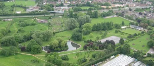
The resulting project (Tools for planning and evaluating green infrastructure – Bicester and beyond) turned out to be the start of a long and fruitful partnership between Oxford University, local councils and nature organisations, co-designing research to support local nature recovery policies.
Thanks to an OPEN policy exchange fellowship, I was able to build on the Bicester work with a six-month placement in Oxfordshire County Council’s Environmental Strategy team, generating the first map of Oxfordshire’s natural capital for use in spatial planning.
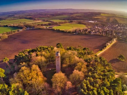
This led to the next opportunity, via the HERO initiative (Healthy Ecosystems Restoration in Oxfordshire) – a lively network connecting local practitioners and policymakers with Oxford academics working on nature recovery. HERO partnered with the Oxfordshire Treescapes Project, set up by two hard-working local enthusiasts with the aim of doubling tree cover in Oxfordshire. With our support, this evolved into a more nuanced system for mapping nature recovery options in a range of ecosystems. Through HERO, we also worked with Oxfordshire’s Local Nature Partnership to estimate the potential for Biodiversity Net Gain to help fund nature recovery in Oxfordshire.
HERO also funded an ecologist (Martha Crockatt) to work with Treescapes. Martha’s arrival sparked another stream of research on fair access to green space, producing an influential report on Oxfordshire’s Greenspace Deprived Neighbourhoods and a new method for assessing green infrastructure equity.
An Agile Sprint on scaling up nature-based solutions in the UK allowed me to extend our natural capital maps to incorporate the Treescapes opportunity mapping approach, producing an open source software system for generating Agile Nature Recovery Opportunity Maps anywhere in England. This mapping system is being used to support production of Local Nature Recovery Strategies (LNRS) in Shropshire, Yorkshire, Somerset and Surrey.
I was also invited to join two of the working groups supporting Oxfordshire’s LNRS, providing advice on data, evidence and prioritisation, and some mapping support. It was fascinating to work with a range of local nature experts to co-produce the strategy, which moves beyond the traditional approach of restoring individual habitats to emphasise the value of mixed habitat mosaics of grassland, scrub and trees.
We were particularly privileged to be entrusted with analysing the results of the public consultation on the draft strategy. With over 1000 responses and only 20 days funding, this seemed like an insurmountable task at first, but fortunately we were able to draw on Klara Kaleb’s AI expertise to help with the initial categorisation. Our report aimed to comprehensively summarise the wide range of excellent points made by the enthusiastic respondents. It was moving to read responses from people who relied on nature for their mental health and well-being, and their grief when much-loved green spaces were threatened by development, but also inspiring to hear from the many people working to support nature across the county.
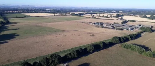
Finally, I was delighted to be approached by Oxfordshire’s four District Councils to help develop a joint nature and carbon strategy as part of the Enabling Nature Based Carbon Sequestration project. While a strategy focused only on carbon would result in intensive planting of fast-growing tree species, this would be a devastating outcome for all the local species that rely on a mixed landscape of native woodlands, grasslands, wetlands, shrubs and heath, and would not be a resilient, high-integrity nature-based solution.
We therefore developed a joint nature-carbon strategy by intersecting the high-level LNRS opportunity map with the more detailed Agile map of Oxfordshire, combining native woodland planting and natural regeneration with restoration of floodplains, heathland, hedgerows and chalk grassland. To minimise trade-offs with food production the strategy avoided loss of high-grade farmland, but aimed to enhance this land for nature and carbon using agroforestry and other agroecology options. Our report showed how this integrated strategy could simultaneously deliver benefits for biodiversity, carbon sequestration and other ecosystem services.
Although it is hard work delivering this stream of short-term projects with limited funding and tight deadlines, it is hugely rewarding. I have learnt so much about the practice and policy of nature recovery from working with local nature groups and policymakers, and the two-way flow of ideas has helped to refine and improve my mapping system to the point where it is being used to deliver real policy impact across England.
I am enormously grateful for all the different funding sources that have helped to make this possible, from the initial NERC grant to the OPEN fellowship, the Agile Initiative, the Oxford Martin School (HERO), the Nature-based Solutions Initiative, the LCNR and the local councils.
Related News Articles
Oxfordshire’s Greenspace Deprived Neighbourhoods
Martha Crockatt I’m writing this in mid-April; although there has been wind, rain and even hail in the last few days, hawthorn, tulips and forget-me-nots are blooming, bees are starting to buzz and the sun, when it does come out from behind a cloud, is warm – it’s a lovely time to be outdoors in […]

Oxfordshire’s green space-deprived neighbourhoods
A report, released today by the researchers in the Leverhulme Centre for Nature Recovery, identifies neighbourhoods in Oxfordshire experiencing both socio-economic deprivation and poor provision of accessible green spaces, with a view to these neighbourhoods being prioritised in terms of planning, allocation of funding, and effort for improving quality and quantity of accessible green spaces. […]
Related Projects
Oxfordshire Treescape Project
Supporting Oxfordshire land managers, parishes and communities with nature recovery planning.
Equitable distribution of nature-rich accessible green space: An Oxfordshire case study
Investigating the distribution of freely accessible green space in Oxfordshire in relation to socio-economic status to inform local green space planning.